The core of the app:
Interactive map and live navigation
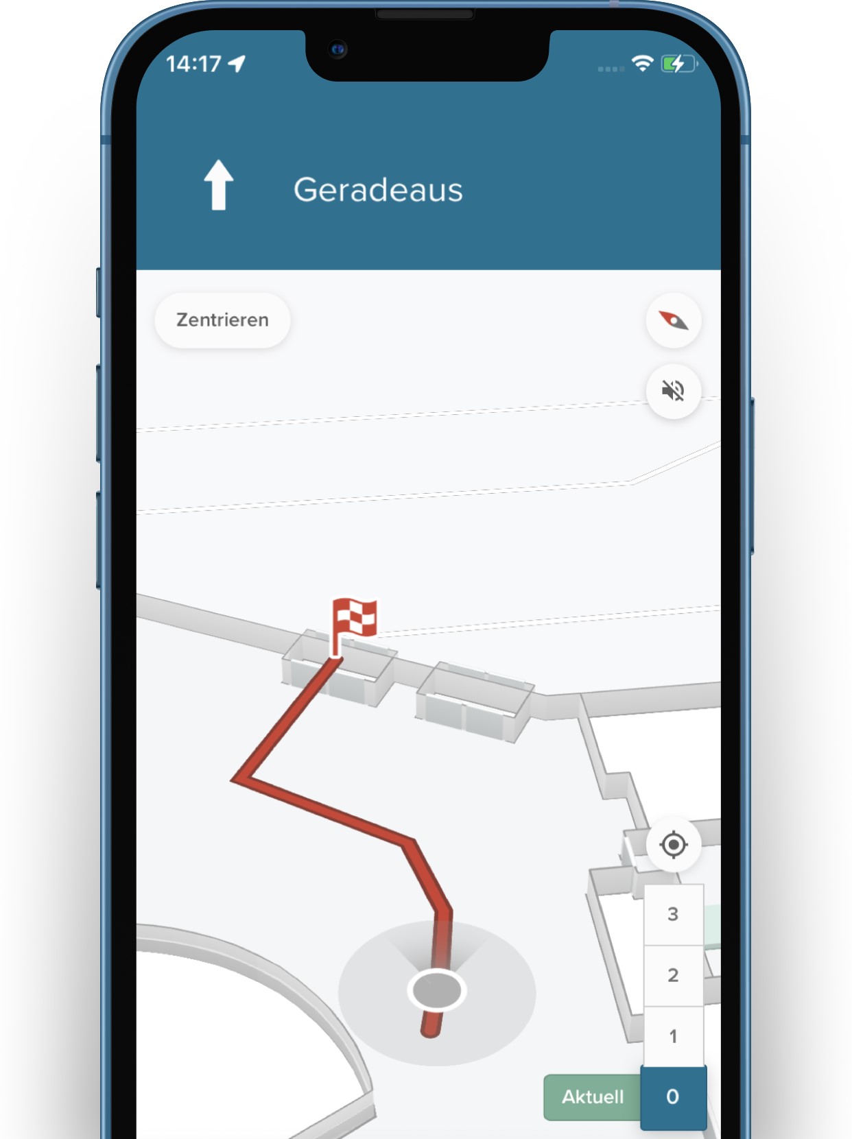
The MOBILE smartphone app helps people find their way around the site and in buildings. The 3D map gives them an overview; the live navigation helps them find their destination.
Our awarded cPS technology calculates the exact position of the user – even indoors and across several floors. This is made possible by a unique combination of different positioning technologies.
Customised news and notifications
for an optimal visitor experience
Ensure a personal approach by switching location-based messages: With the help of notifications, you can realise interactive audio guides or event information, for instance.
As soon as a visitor enters an area with a geofence, the app automatically presents relevant content. Time-based campaigns and news can also be created with the EDITOR backend.
The core of the app:
Interactive map and live navigation
The MOBILE smartphone app helps people find their way around the site and in buildings. The 3D map gives them an overview; the live navigation helps them find their destination.
Our awarded cPS technology calculates the exact position of the user – even indoors and across several floors. This is made possible by a unique combination of different positioning technologies.
„The smart phone has revolutionized my life.“

Daniel K.
(Blind from birth)
Ihre Vorteile im Überblick
Interaktive Karten: Erleichtern Sie Besuchern die Orientierung! Zeigen Sie Panoramen direkt aufrufbar an den exakten Standorten auf Ihrer Karte.
Freie Perspektivwahl: Sie entscheiden selbst, was wo angezeigt wird: Ansichten von innen oder außen, vorhandene Bilder oder ganz neue Aufnahmen.
3D-Besichtigungen: Erlauben Sie Interessierten Ihre Lokation virtuell zu entdecken. Mit 3D Rundgängen wecken Sie Interesse und motivieren zum Besuch.
Anreisen planen: Gäste können ihre Anreise und ihren Besuch vorab detailliert planen. So finden sie sich nach der Ankunft sofort zurecht.
Barrierefreiheit unterstützen: Dank der 360° Bilder können Behinderte die Gegebenheiten vor Ort einsehen – für einen Besuch ohne Hindernisse und Wartezeiten.
Suchen verringern: Verschaffen Sie Ihren Gästen und Mitarbeitern ein lebensechtes Gebäude-Abbild, damit sie schneller finden, was sie suchen.
Präzise Dokumentation: Mehr Transparenz und Nachvollziehbarkeit: Halten Sie Inventar-Standorte und Änderungen auf Ihrem Areal bildlich fest.
Bessere Vermarktung: Präsentieren Sie ihr Gebäude auf optimale Weise und finden Sie schneller Interessenten für Ihr Objekt.
Höchster Datenschutz: Sie behalten die Rechte an Ihren Panorama-Bildern. Anonymisierung und ein Zugriffssystem gewährleisten DSGVO-Konformität.